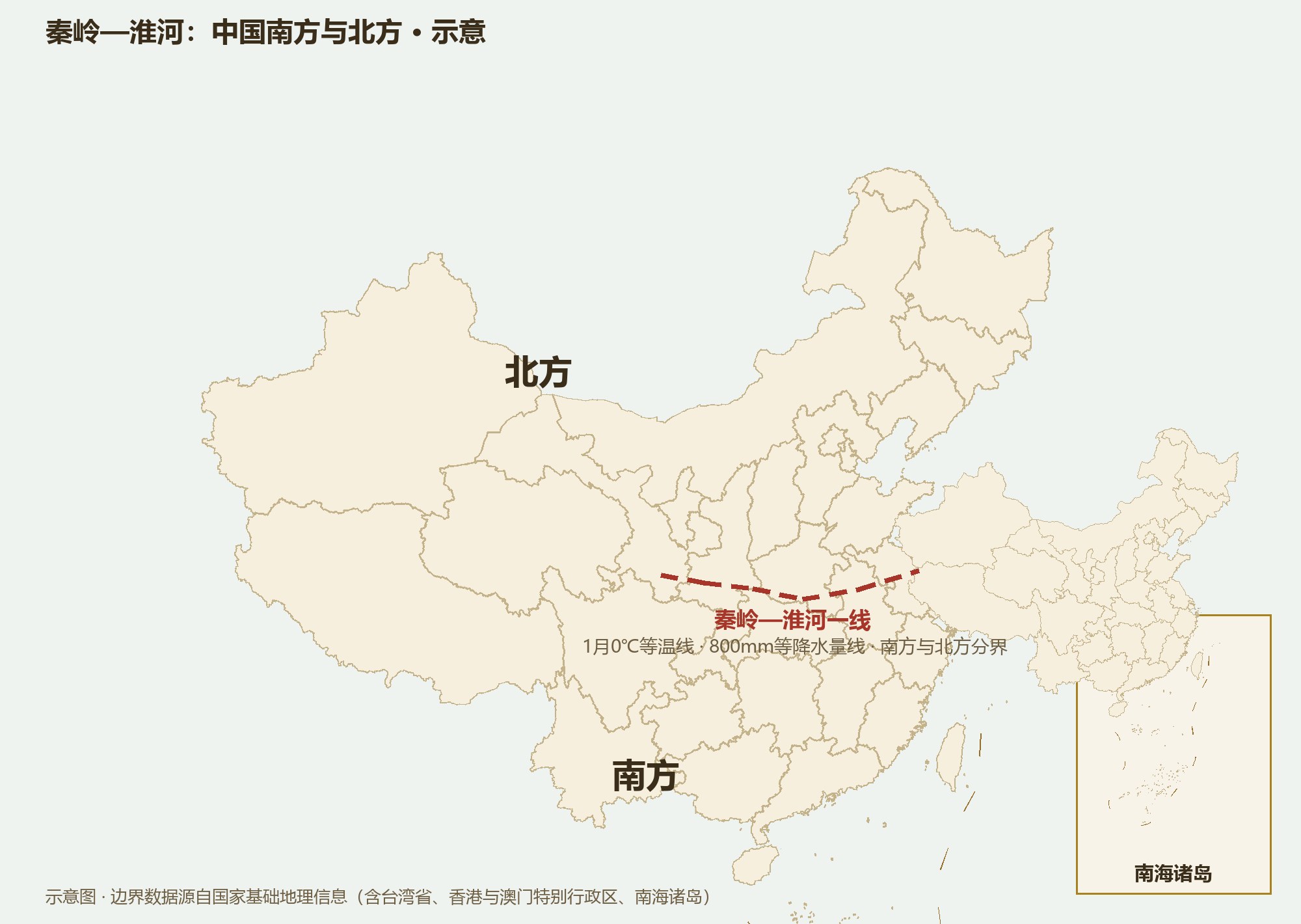
One invisible line: the January 0°C isotherm and the 800-mm rainfall line. The differences between northern and southern China were drawn by this line.
No north–south boundary is printed on China’s map, but every Chinese person carries one in mind: the Qinling–Huai line. It runs more than 1,600 km from east to west — the January 0°C isotherm, the 800-millimeter rainfall line, and the divide between rice and wheat, paddy and dry field, boat and cart.
The Qinling–Huai line is four lines at once: the January 0°C isotherm — rivers freeze north of it, not south; the 800-mm annual rainfall line — semi-humid to the north, humid to the south; the boundary between the warm-temperate and subtropical zones; and the boundary between humid and semi-humid regions. Four lines overlapping on one geographic belt is no coincidence: the Qinling blocks the southbound cold waves, and the Huai collects the northbound moisture.
The Qinling, rising 2,000–3,000 meters, works like a wall — winter cold waves are greatly weakened crossing it, which is why the Sichuan Basin winters far warmer than the Yangtze–Huai region at the same latitude. The two latitudes match; the climates do not.
Staple food: wheat noodles north, rice south. Transport: carts and horses north, boats south. Houses: flat roofs and thick warming walls north, steep roofs and high eaves to shed the rain south. Vegetation: deciduous broadleaf forest north, evergreen south. Even the stereotypes about dialects and temperament roughly follow the line.
The line also split two farming systems: the dryland north where “one grain of millet is sown in spring,” and the paddy south where “rice fragrance speaks of a good year.” China’s two forms of farming civilization developed in parallel on either side of a single line for two thousand years.
The Qinling–Huai line is really a transition belt several hundred kilometers wide. People of the Huai valley grow rice and wheat alike and eat both; Xuzhou in Jiangsu feels like the north while Suzhou in the same province feels like Jiangnan. To those who live inside the belt, “north and south” is a gradient, not a wall.
The line even has a modern afterlife: central heating in China is roughly distributed along it — radiators north, none south. Every winter, residents on both banks of the Huai reopen the debate about whether a line drawn in the 1950s still makes sense.