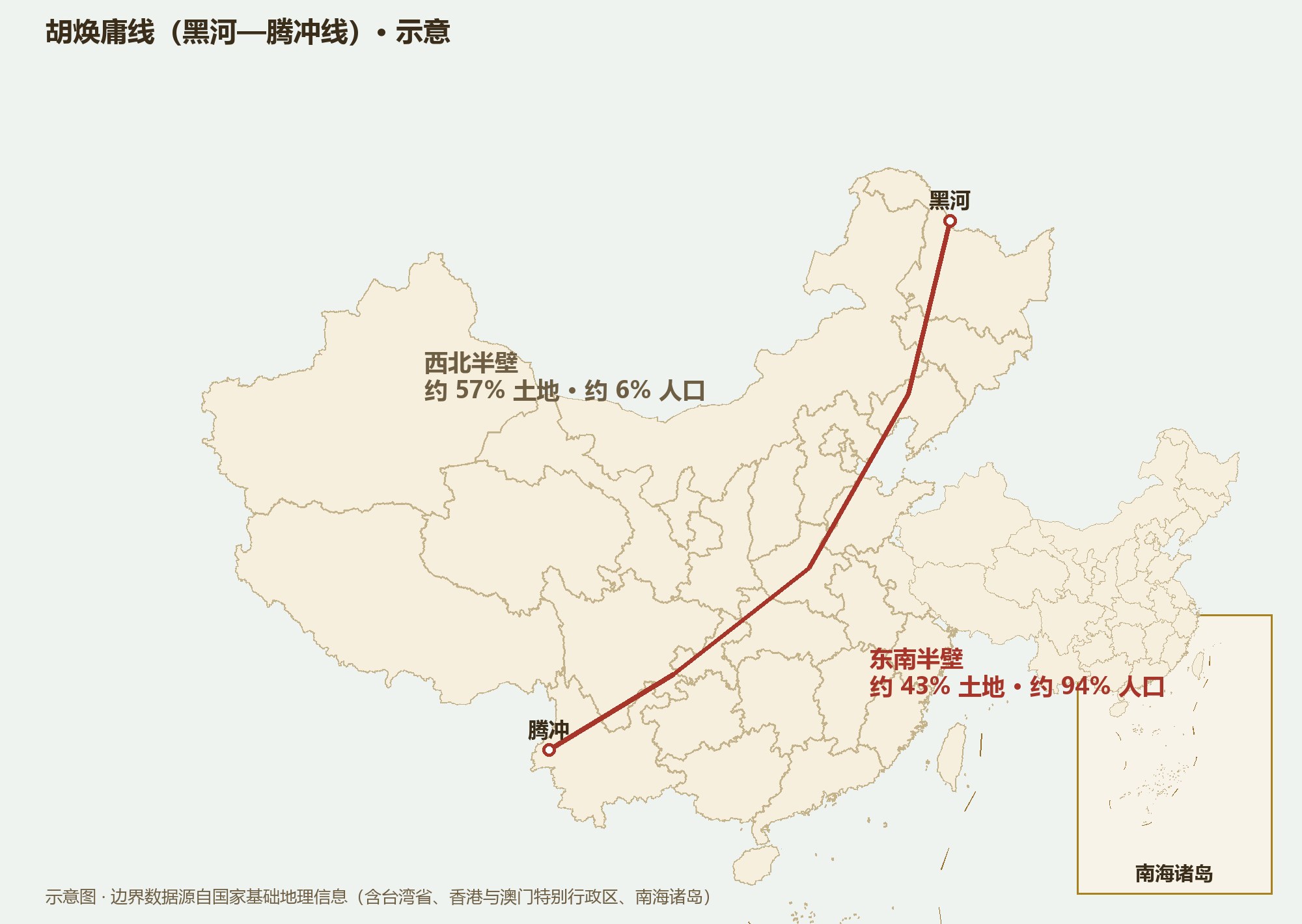
A straight line drawn in 1935, from Heihe to Tengchong. Southeast of it, about 43% of the land holds about 94% of the people — eighty years on, the line has barely moved.
Open a night-time satellite image of China and the east is a sea of lights while the west lies dark — and that boundary of light was drawn with a single pen stroke back in 1935, by the geographer Hu Huanyong. Population is never random; it is the vote cast by terrain, climate and water.
In 1935 Hu Huanyong published China’s first population-density map and drew a straight line from Heihe in Heilongjiang to Tengchong in Yunnan: southeast of it, about 36% of the land held about 96% of the people. More than eighty years later, the Seventh Census (2020) still reads roughly 43% of land against 94% of people — through the greatest rural-to-urban migration in history, the line has hardly budged.
Why so stable? Because the southeast is where the monsoon reaches, the plains are wide and the water ample; the northwest is plateau, desert and frost. Population was written into the natural conditions — policy and markets can tune it, not rewrite it.
The most populous province is Guangdong (about 126 million in 2020), followed by Shandong, Henan, Jiangsu and Sichuan — the top five all lie east of the Hu Line. People keep converging on cities: the four great city clusters of the Yangtze Delta, the Pearl River Delta, Beijing–Tianjin–Hebei and Chengdu–Chongqing hold about forty percent of the population and over half the economy.
The urban resident share has climbed from about 18% in 1978 to about 66% in 2023. For the first time in several thousand years, most Chinese live in cities — the greatest shift in China’s human geography on record.
Northwest of the line, Tibet, Qinghai, Xinjiang and Inner Mongolia together approach half the national territory but hold under 4% of the people; Tibet counts roughly three persons per square kilometer, among the sparsest on Earth. But “empty” does not mean “useless”: that half is China’s water tower, its energy reserve, its ecological shield, and the westward corridor of the Belt and Road.
To understand China’s population you must hold two sentences at once: nine in ten Chinese crowd the east because that is where people can be fed; the other half of the map must be left open because it supplies water, ecology and strategic depth — both halves are indispensable.